

Starting any construction or home renovation project means that you’ll need detailed information about the property. Even if you’ve lived in it for years, there’s a lot you might not know about your own home.
Whether you’re planning an extension on your family home, about to undertake a large-scale commercial development, or working on a listed property, having up-to-date and precise measurements is essential.
This article explores what measured building surveys contain and why it’s important to understand these components. For personalised advice, contact our team at Baypoint Surveys today.
Why Do I Need a Measured Building Survey?
A measured building survey is essential for projects of any size, whether that’s a residential renovation, commercial development, or completely new build. Measured building surveys provide precise and up-to-date plans that architects and engineers need so that they can streamline the design, planning, and construction process.
Residential Projects
For residential projects such as renovations or extensions, accurate plans allow architects to design layouts that integrate the new structures with the existing ones. If planning permission is required, a measured building survey can show the current layout alongside the proposed design.
Commercial Projects
For commercial projects, measured building surveys can help to maximise space and make sure the development is compliant with health and safety regulations. Having exact measurements from the beginning also helps to identify potential risks and challenges, helping to tackle issues early and ultimately reduce costs and delays.
No matter the scale, measured building surveys make projects more cost-effective and efficient. By starting with the most precise data possible, you’re setting the stage for a smooth and successful build.
What are Floor Plans, Elevations, Sections, and Street Scenes?
Measured building surveys produce several deliverables, each with its own unique purpose. These are:
- Floor plans— Used by architects to design room layouts and ensure space is used optimally
- Elevations— To show the external views of the building so architects can design extensions to match the existing structure
- Sections— Detailed cross-sections provide more information on how internal and external floors work together, offering valuable insight into a building’s structure
- Street scenes— Demonstrating how a proposed development will look from the road and helping architects ensure the design fits in with the surrounding properties
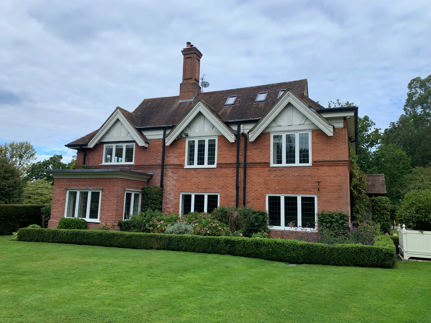
Photograph of Elevation

Point Cloud of Laser Scanned Property
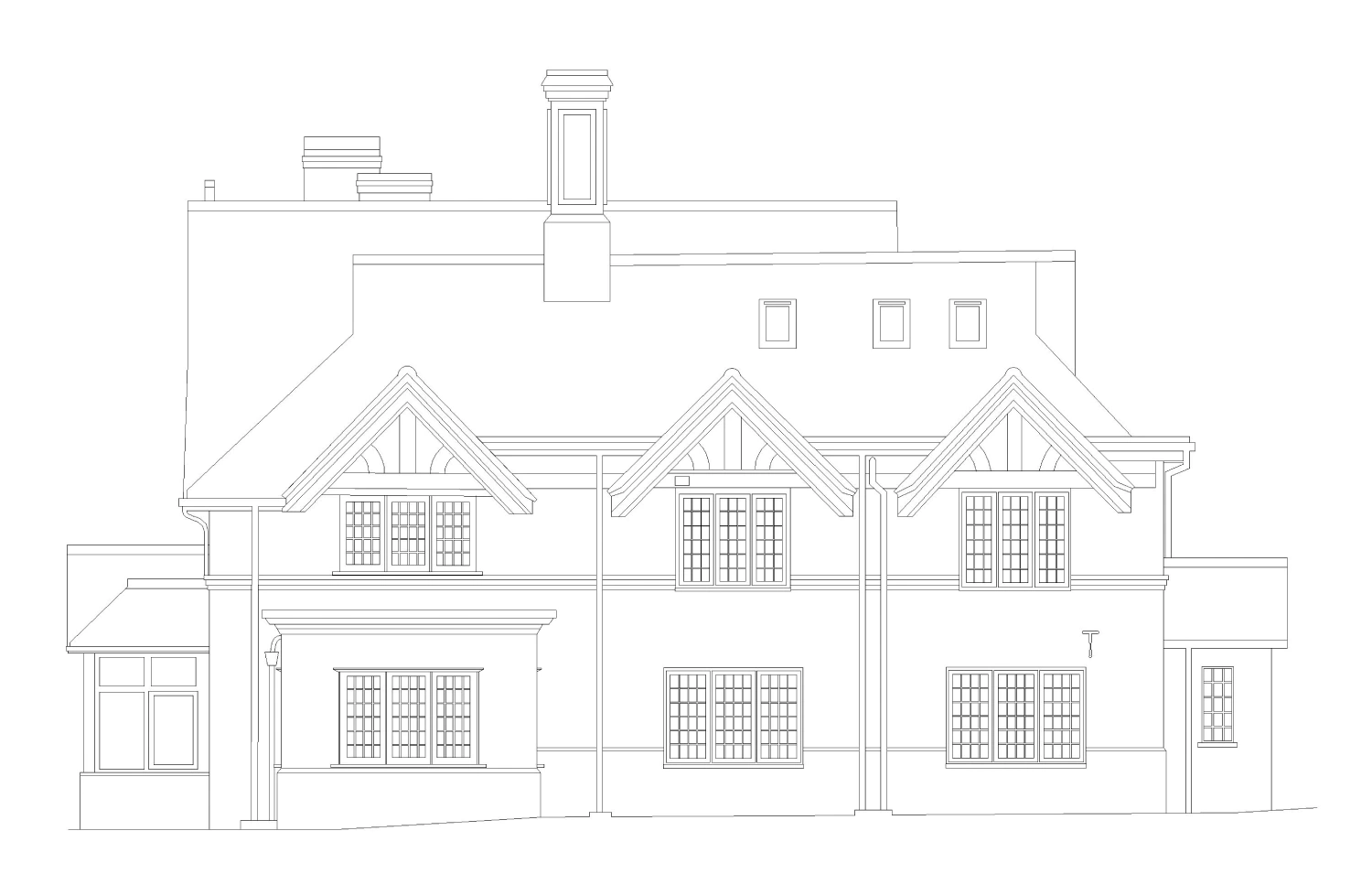
Final Elevation
Does it Matter How They are Measured?
Yes, it does, as the accuracy of the measured building survey depends on the measuring method used. Different approaches can be used, and some are more reliable than others. Methods include:
- Measuring tape, pencil, and paper— This is the traditional method that served its purpose, but is now less commonly used. It is time-consuming and prone to errors, making it unsuitable for projects requiring precision
- Tablet and electronic devices— This method is faster and more accurate than measuring tape and a pencil, but isn’t suitable for every project— this is best suited for newer builds with simple layouts
- Laser scanners (Baypoint’s method)— At Baypoint Surveys, we use this state-of-the-art method that offers accuracy while minimising time spent on-site (and intrusion for property owners). These laser scanners capture millions of data points a second, producing highly detailed 3D Point Clouds. From these point clouds, we use the latest Scan to CAD software, to create the final 2D CAD plans and precise measurements for even the most complex buildings.
At Baypoint Surveys, we’re proud to rely exclusively on laser technology, ensuring every measurement is accurate and reliable.
Are There Different Specifications Available?
If you’re concerned about keeping costs down, there are different standards available. Here are the various costs compared to the Standard Survey specification of 100%:
- CIL (Community Infrastructure Levy)— This cost-effective option is 30-40% of the standard cost and involves measuring room areas, ideal for new build projects, where the existing build is being demolished
- Basic— Covering main structural features but excluding levels, this option comes in at 50-80% of the standard cost and is sometimes required for demolitions, or simpler developments
- Standard— The most popular choice at 100% of the standard cost, the standard option provides plans that meet most architect’s needs
- Detailed— The highest level at 120-150% of the standard cost, this is suitable for listed buildings and those with intricate architectural features
Which Specification is Suitable for My Project?
The ideal specification will depend on your project’s unique requirements:
- CIL— Best for new build projects, this minimal option provides essential data for planning and compliance
- Basic— Suitable for projects that are due to be demolished, or small residential projects. The basic level includes key structural features but not detailed levels
- Standard— Good for most residential and commercial projects, the standard option covers the features architects usually need
- Detailed— Detailed is great for listed or ornate buildings where there are intricate details that need to be captured for restoration or preservation
At Baypoint Surveys, we understand that clients will need different standards depending on their projects. We work closely with both clients and architects to recommend the most suitable standard, keeping costs down as much as possible while still meeting the project’s needs.
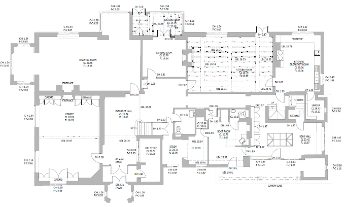
Standard Specification – Ground Floor Plan
Choose Baypoint Surveys for Expert Services
At Baypoint Surveys, we combine cutting-edge technology with over 35 years of expertise to deliver outstanding measured building surveys. Trusted by clients across Bournemouth, Dorset, and beyond, our fully qualified staff are dedicated to delivering accurate results. We adhere to strict health and safety standards, and for extra peace of mind, we also provide Professional Indemnity insurance of up to £1,000,000.
Whether you’re interested in precise 2D plans or 3D Point Clouds, we offer tailored solutions with our professional, reliable, and efficient services. To find out more or to get started on your project, contact us today.
