
If you’re getting ready to build, you might be wondering what surveys are necessary before you start. Topographical surveys are a crucial step in any construction process. They’re not just an additional cost but an investment in ensuring your project runs smoothly. But why are they so important?
In this article, we’ll outline what you need to know. From what topographical surveys are, how they work, and why they are a necessary part of any successful construction project. No matter what type of project you are working on, understanding the value of topographical surveys will help you avoid costly mistakes and ensure your project stays on track.
For personalised advice, contact our team at Baypoint Surveys today.
What is a Topographical Survey?
A topographical survey is a detailed mapping of the natural and man-made features of a specific area of land. It captures the location, elevation, shape, and contours of the terrain. Likewise, it also assesses structures like buildings, roads, trees, and utilities.
This information is presented in a visual format, often as a 2D map or 3D model. This helps architects, engineers, and planners make informed decisions during construction. Ensuring that development and design projects can proceed smoothly.
Topographical surveys are essential for understanding site conditions and ensuring projects are accurately planned and executed.
How are They Conducted?
Topographical surveys are conducted using a combination of advanced equipment and precise measurement techniques. Here’s a step-by-step overview of the process:
- Initial Planning:
Surveyors assess the site, identify key features to be measured, and plan the most efficient method for data collection.
- On-Site Data Collection
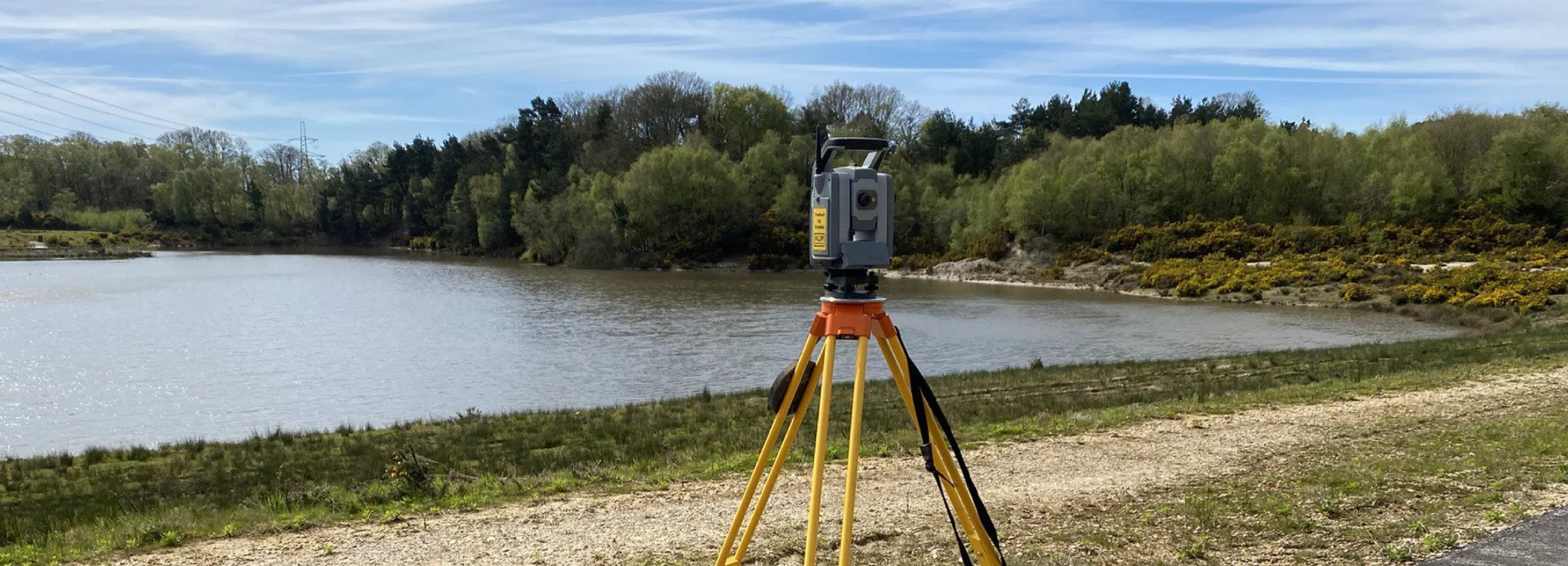
Using specialised equipment such as total stations, GPS receivers, and 3D laser scanners, surveyors measure the position, elevation, and contours of the land. Drones may also be used for aerial data capture, especially on large or hard-to-access sites.
- Data Processing
The collected data is transferred to software, where it is processed and converted into accurate 2D maps or 3D models. This stage ensures the removal of errors and alignment of data points.
- Analysis and Reporting
Surveyors analyse the data to create a comprehensive visual representation of the site. This report highlights key features and any potential challenges or considerations for development.
- Final Delivery
The final survey is shared with clients, architects, engineers, or planners. This is then used to support the planning and development of construction projects.
Why do People Need Topographical Surveys?
People need these surveys to support construction, development, and planning projects. They provide precise data on the terrain, existing structures, and utilities. This helps avoid costly mistakes and ensures compliance with regulations. It is also invaluable in facilitating the design of safe and efficient projects.
Whether it’s for new builds, renovations, or infrastructure work, topographical surveys offer the detailed insights necessary to make informed decisions and ensure project success.
The Benefits of an Accurate Topographical Survey
Topographical surveys provide a variety of benefits when it comes to construction projects, such as:
Informed Decision-Making
Topographical surveys provide accurate data on land features, helping architects, engineers, and planners make informed decisions about design and construction.
Cost Efficiency
By identifying potential issues early, topographical surveys help avoid costly mistakes and delays during development or construction.
Regulatory Compliance
Surveys ensure that projects adhere to local zoning and building regulations, reducing the risk of legal complications.
Improved Planning
Detailed site data supports the development of precise plans and designs, ensuring projects are built to specifications and minimise risks.
Enhanced Accuracy
Topographical surveys provide highly precise measurements of terrain. This ensures that design plans align with the actual land conditions, minimising errors.
Efficient Project Management
With detailed site information, topographical surveys help streamline project timelines. This enables better resource allocation and more efficient coordination between teams.
How to Ensure Your Topographical Survey is Accurate
At Baypoint Surveys, we understand that accurate topographical surveys are crucial for the success of any construction project. To ensure your survey meets the highest standards, we follow a thorough process that includes the latest technology, industry certifications, and meticulous quality control.
We Are Qualified and Experienced
With over 35 years in the surveying industry, we have built a reputation for providing reliable, high-quality surveys. Our team is highly qualified and experienced in delivering topographical surveys for a wide range of projects, from small developments to large-scale construction. We leverage this expertise to ensure every survey is accurate, detailed, and tailored to the specific needs of your project.
We Use the Latest Equipment and Technology
To deliver precise results, we invest in the latest surveying technology. We use advanced equipment such as robotic total stations, GPS systems, and 3D laser scanners, ensuring we capture accurate data across a variety of site conditions. We also use drones for aerial surveys, especially on large or difficult-to-access sites, allowing us to gather data efficiently and precisely.
We Hold Relevant Qualifications and Accreditations
We are committed to maintaining the highest standards of practice. Baypoint Surveys is a member of The Survey Association (TSA), which ensures that we adhere to industry guidelines and best practices. Our team is fully insured, and we follow stringent health and safety protocols to maintain a safe and compliant work environment.
We Ensure Clear Communication and Defined Scope
We believe that clear communication is key to an accurate and successful survey. Before we begin, we work with you to clearly define the scope of the survey, making sure we understand your specific requirements. This ensures that we collect all the necessary data for your project and avoid any gaps or errors.
We Conduct Regular Quality Checks and Data Verification
To maintain the highest level of accuracy, we implement regular quality checks throughout the surveying process. Our team carefully reviews all collected data during and after the survey to ensure it meets our rigorous standards. We also verify data with advanced software to correct any discrepancies, ensuring the final survey is precise and reliable.
We Prioritise Health and Safety Compliance
Safety is a top priority in all our projects. We ensure that our team adheres to the latest health and safety regulations to protect both our staff and your project. Our health and safety practices are fully accredited, providing you with peace of mind that all surveys are conducted in a safe and compliant manner.
We Offer Comprehensive Surveying Services
At Baypoint Surveys, we provide a wide range of surveying services, including topographical surveys, measured building surveys, utility mapping, 3D laser scanning, and drone surveys. Our comprehensive approach means we can handle every aspect of your project’s surveying needs, ensuring a smooth and efficient process from start to finish.
By choosing Baypoint Surveys for your topographical survey, you can trust that your project is in capable hands. We are dedicated to delivering accurate data, supporting your planning and construction efforts, and helping you achieve your project goals with confidence.
Trust Baypoint Surveys to Deliver
Baypoint Surveys’ approach to topographical surveys sets the industry standard. We are fully qualified and insured, with health-and-safety accredited professionals. Our comprehensive range of services includes topographical, GPS, engineering, and as-built surveys.
Leveraging the latest equipment and advanced scanning technology, Baypoint Surveys ensures precise, reliable results every time. With over 35 years of experience, we continue to deliver exceptional service and expertise, making us a trusted partner for all land surveying needs.
