Monitoring surveys are the most effective way to track changes to your site or structure. By monitoring essential data, such as changes in position, ground levels, and the dimensions of a structure, they can help you effectively manage potential risks. At Baypoint Surveys, we use the latest monitoring equipment to ensure accuracy at every turn.
Movement Measuring
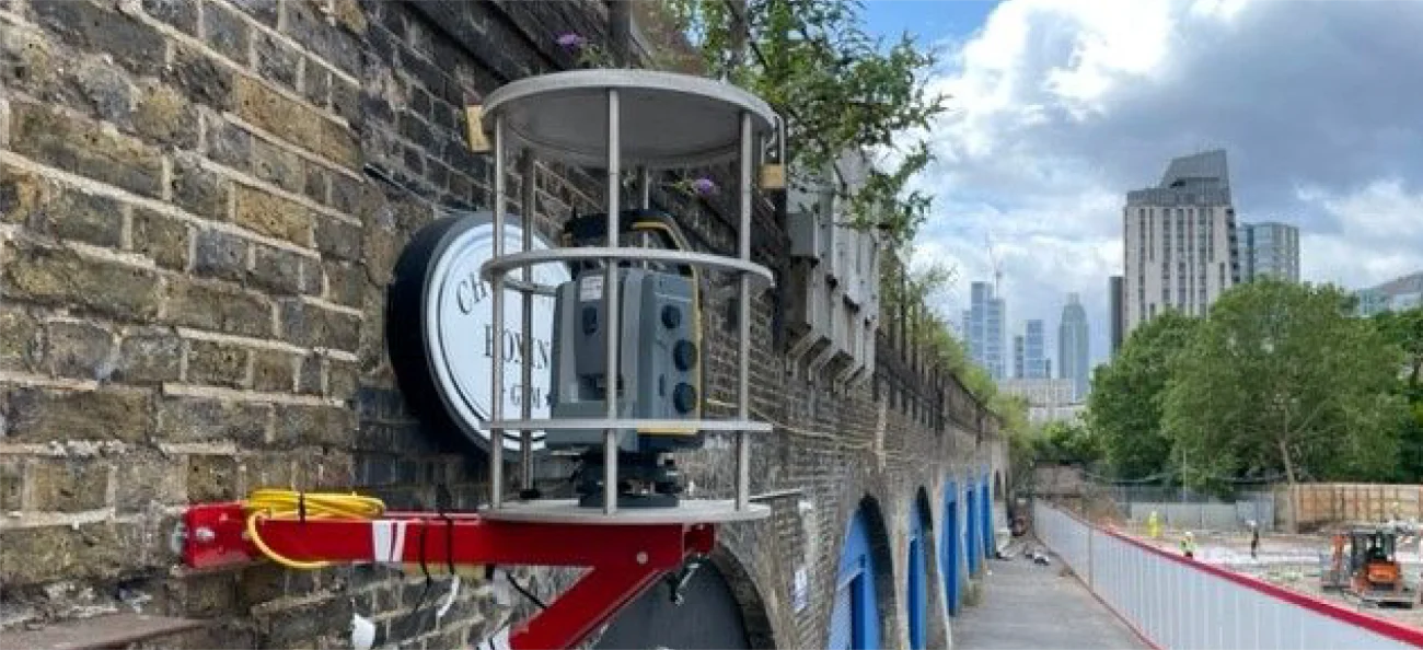
Movement measuring detects the movements and deformations of a site or structure. Using high-accuracy 1” Total Stations, Lidar Drones, Terrestrial Laser Scanners and leading-edge software, our team can record accurate results of a variety of environments, such as:
Marinas
Cliff faces and embankments
Listed/Historic buildings
Internal ceilings
Residential and commercial buildings
Ground levels
Boundaries
Concrete slabs
Rail embankments and cuttings
Rail tracks
Bridges
Landfill sites
The Applications of Monitoring Surveys
Civil Engineering
Monitoring bridges, tunnels, dams and structures for shifting ensures that they are secure and structurally sound.
Geotechnical Engineering
Monitoring surveys can also assess landslides, slopes and enbankments for structural integrity.
Mining
Tracking ground subsidence and deformation in mining operations can help protect miners and investments.
Geodesy and Geology
Researchers and authorities often monitor tectonic shifts, fault lines and volcanic activity for safety reasons.
Transportation
Monitoring railways, highways and airport runways can ensure that repairs are conducted as soon as they are needed.
Ensure your construction project is on track with a monitoring surveyor you trust.
A monitoring survey helps establish baseline measurements and track small changes over time. It is often used to detect horizontal movement, subsidence, or structural shifts that may affect new builds, adjacent properties, or existing structures.
Yes. Monitoring surveys are commonly used as part of a party wall agreement to track any movement that may result from neighbouring construction. This ensures all parties are protected and remedial action can be taken if required.
The frequency of site visits depends on the package we create for each project. We’ll recommend a schedule based on the site conditions, potential issues identified, and the level of risk involved.
The cost of your monitoring survey will depend on the size and scope of your project. To get an estimate of how much your specific project may cost or for further information, contact our team today.
Monitoring surveys can be conducted for any duration. Many people choose between short-term surveys conducted during construction and long-term surveys conducted after construction is complete.
A dedicated team and a survey manager will be assigned to your project so that you can receive professional support and interim reports at regular intervals.
All of our team members are fully qualified and, once the project is ready to commence, we will send you the necessary details, including start date, time, your surveyor’s name and contact details.
Most of our surveys come in various formats, from spreadsheets and 2D plans to cross-sections and heat maps produced from the comparison of point clouds. These files are generally delivered as 2D DWG and PDF files, though if you prefer, they can be sent in different formats.
The Baypoint Surveys Difference
Trusted Experience
Every member of our team is fully qualified with years of experience.
Professional Insurance
We offer Professional Indemnity Insurance to ensure our clients are covered.
Diverse Environments
From domestic projects to offices, infrastructure and more, we know how to navigate different environments.
Prioritising Safety
We hold health and safety accreditations to ensure compliance with relevant safety regulations.
Sensitive Expertise
We have worked professionally on sensitive government, Network Rail, and NHS sites, among others.
TEC have worked with Baypoint over a number of years and have maintained a great working relationship with them. Their staff are great and always respond promptly!
Over the years we have found Baypoint to be extremely accommodating, professional and willing to assist us, providing additional advice whenever needed.
We wouldn’t hesitate to recommend them!”
We’ve been using Baypoint for the last 5 years and I can only say positive things about my experience with them. Everyone in the team is fantastic. They always turn up when they say will, are great to have on site and make the job look easy! I never hesitate to recommend them and are the only surveyors I will use.
Baypoint Surveys Ltd have supported us with the provision of topographical surveys for a vast range of railway projects.
Projects have included bridge replacement, strengthening and refurbishment schemes as well various rail structures.
We are grateful for their flexibility to resource emergency works and last-minute changes in track access.
We look forward to continuing our working relationship.
Baypoint have provided an exceptional service for us across our sites over the past two years. They have shown tenacity in their approach, and their ability to work through challenges with us, going above and beyond to ensure a high-quality service and output. Their team is approachable, friendly and overall, a joy to work with.
The Right Surveyor For Your Project
At Baypoint Surveys, we take pride in the accuracy of our reports. Ensure you have all the relevant information and can identify potential problems before work begins with our survey services. Reach out to our team at the earliest opportunity to keep your sites safe.